Directions/Maps
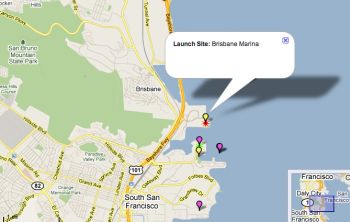
Brisbane Marina is the first marina south of San Francisco and north of Oyster Point.
Water Directions:
GPS coordinates for the channel entrance to the Brisbane Marina are: 37º 40.30 N and 122º 22.20 W. The channel entrance is flanked by two daymarkers, green "1" and red "2". Six total channel markers guide mariners due west. To enter the marina change course to 90º starboard immediately after red daymarker "6", and head due north through the entrance.
Driving Directions:
From 101 Southbound: Exit Sierra Point Parkway. Continue straight on Sierra Point Parkway after the stop sign. The lagoon will be on your right and you will eventually cross under the freeway. Keep going straight all the way to the waterfront.
From 101 Northbound: Exit Sierra Point Parkway. Turn right onto Sierra Point Parkway which leads to the waterfront.
Click the map image to go to the BASK trip planner